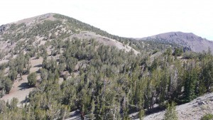
Mt. Houghton: A New Mountain to climb

By Tim Hauserman
You don’t really need an excuse to hike the Tahoe Rim Trail, but when a new segment or realignment pops up, it’s well worth checking it out. It’s sure to be beautiful, and those Tahoe Rim Trail Association trail builders are the best in the business.
A few days ago, I climbed to the top of Mt. Houghton from the Tahoe Rim Trail/Mt. Rose Trailhead. The first two miles, which includes an easy walk to Galena Falls, are perhaps the busiest segment of the entire TRT. The trail then leaves the crowd behind and winds it’s way to a crossing of the old Mt. Rose Trail. Here new trail begins heading up to the ridge, where two high points, Mt. Houghton and Relay Peak, are both over 10,000 feet in elevation.
It’s a steady, but only moderately steep climb through volcanic boulders and open slopes to the ridge. Take frequent breaks to catch your breath and enjoy the view. At the ridge top you meet a junction. The TRT turns left and the 3/4 mile trip to Mt. Houghton goes right. The trail builders have done wonders switchbacking through the stunted whitebark pines on the twenty minute jaunt to the windswept summit of Houghton, where the panoramic views include the Mt. Rose Wilderness to the north and west, and Tahoe Meadows and Lake Tahoe to the south.
From the top of Houghton retrace your steps to the junction, then follow the TRT as it traverses the steep north slope of the ridge, passing the Relay Towers, Eventually you climb to Relay Peak, at 10,300 feet, the highest point on the TRT. You could return the way you came, but why not continue on and hike a loop of about the same distance? You begin with several long switchbacks down past the Slab Cliffs, then through some volcanic terrain to a junction. A left turn takes you on the Incline Lake trail back to Highway 431. It begins with a traverse to a saddle with awesome Lake Tahoe views, then descends steeply through a forest of some of the biggest western white pines and hemlocks you will encounter in the Sierra. The trail ends with a slight ascent to a paved road where you turn left. Follow it to the Highway 431. Cross the street and join the TRT, where you walk through Tahoe Meadows back to your car.
Need more info? Pick up a copy of Tahoe Rim Trail: The official guide for hikers, mountain bikers and equestrians.

 Trudi Lee has been selling and listing residential real estate at North Lake Tahoe for over 30 years. Her real estate philosophy maintains a meticulous attention to the needs of her clients…